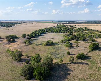
2.27 Acres, Nevada High Desert
15th St : Elko, NV 89801
Elko County, Nevada
Lot Description
Owner Financing:
- $205 down (plus the $249 non refundable doc fee)
- $205 down $205/Mo for 48 months (plus prorated taxes and note maintenance fee)
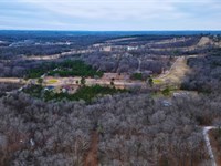
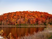
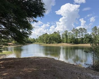
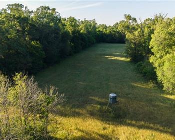
2.27 Acres in Elko County, Nevada - Wide Open Land at an Entry-Level Price
There is a version of your weekends that looks completely different from what they look like right now.
No apartment walls. No parking lot views. No inbox waiting for you on Monday morning reminding you that nothing about your life has the space you have been craving.
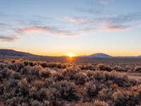
Just flat Nevada high desert stretching in every direction. A sky that goes darker than anything you have ever seen after the sun drops. The kind of quiet that does not exist inside city limits, inside suburbs, inside anywhere you have lived before. And land beneath your feet that belongs to you.
That version of your weekends starts at 2.27 acres in Elko County, Nevada - and it starts for $205 down.
What This Land Actually Is
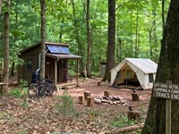
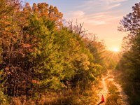
This parcel sits in the northeastern corner of Nevada, in a stretch of high desert that most people drive past on the interstate without realizing what they are passing. It is accessed via 15th Street, a county-maintained dirt road that puts you right on the property without complicated navigation or guesswork.
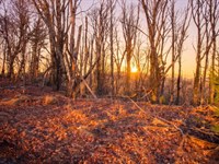
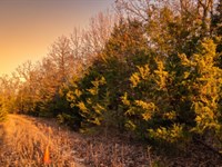
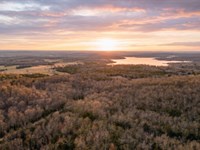
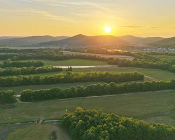
The terrain is flat. Genuinely flat. Elevation runs from 5,343 to 5,352 feet - a nine-foot variation across the entire parcel. That means no steep grades to contend with, no erosion channels cutting through the middle of your land, no surprises when you arrive. Just open, usable ground with native sagebrush and high desert grasses and nothing standing between you and the horizon.
At 2.27 acres, this is real land. Not a sliver. Not a corner lot dressed up as a rural parcel. Two and a quarter acres of Nevada desert means room to spread out, room to set up camp on one end and still feel like the rest of the land is waiting for you. It means views in every direction. It means no neighbor twenty feet away when you wake up in the morning.
No HOA. Elko County is one of the most landowner-friendly counties in the state, which matters when you are the one deciding what your land is for.
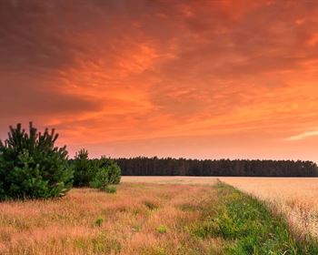
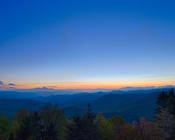
The Sky Above This Land Is the Real Feature
People who have spent time in the Nevada high desert at elevation will tell you the same thing: the night sky is not something you are prepared for the first time you see it.
At 5,343 feet above sea level, far from the light pollution of any major city, the sky above this parcel does what skies are supposed to do. The Milky Way is not a suggestion - it is a solid band across the darkness. Stars you have never seen from Sacramento or Reno or anywhere in between come out by the thousands when the sun goes down. Meteor showers, satellite passes, the slow rotation of constellations you learned the names of once and forgot because you never had a reason to look for them.
This is the kind of sky that changes how a night feels. It is not an amenity. It is not a feature you check off a list. It is the reason people who buy land like this come back.
Land That Has Meant Something for a Long Time
Elko County is not empty land with no story. It is land with more history than most people realize when they pass through.
The California Trail - one of the primary overland routes used by emigrants heading west during the 1840S and 1850S - passed through this region of northeastern Nevada. Hundreds of thousands of people crossed this terrain on foot, on horseback, and by wagon, navigating the same high desert landscape you would be standing on. The California Trail Interpretive Center, located nearby, tells that story in full. It is worth a visit not just as a tourist stop but as a reminder that this land has been meaningful to people moving through it for nearly two centuries.
The broader Elko County area carries that same weight. Wells, Elko, and Carlin - the closest towns to this parcel - each have their own history tied to the westward expansion, the railroad era, and the mining booms that shaped the modern West. This is not generic desert. This is land with a past that goes deeper than most buyers think to ask about.
When you own a parcel in this part of Nevada, you are not just buying acreage. You are buying a piece of ground that has mattered to people for a very long time. That is worth something that does not show up on a spec sheet.
Recreation Within Reach
One of the things that separates this corner of Nevada from cheaper, more remote parcels with no access and nothing nearby is what surrounds it.
Lamoille Canyon Scenic Byway is one of the most underrated drives in the American West. Carved into the Ruby Mountains southeast of Elko, the canyon walls rise sharply on both sides of a winding road that follows a glacier-carved valley floor. In summer, the wildflowers are dense and the streams run clear. In fall, the aspens turn gold across the canyon walls in a way that does not look like it belongs in Nevada. Most people who live outside the state have never heard of it. Most people who have driven it never forget it.
South Fork State Recreation Area offers fishing and camping on a reservoir in the high desert - a combination that feels unexpected and earns its reputation among people who know northeastern Nevada well.
The Northeastern Nevada Museum in Elko is worth an afternoon if you want to understand the region - its geology, its wildlife, its human history from the Shoshone people through the ranching and mining eras to the present. It is a small museum that punches well above its weight.
US Highway 80 and Route 225 connect this parcel to the region efficiently. Wells, Elko, and Carlin are all within a reasonable drive - close enough for supplies and a meal, far enough away that you never feel like you are in their backyard.
The Road In and What It Tells You
A lot of affordable rural land in Nevada comes with a catch buried in the fine print - a landlocked parcel, an easement dispute, a road that technically exists but has not been maintained in years. This one does not have that problem.
15th Street is a county-maintained dirt road. County maintenance means the road is on record, maintained by a public entity, and not dependent on a neighbor's goodwill or a private agreement that could change hands. You drive in on a road that exists officially and gives you legal, documented access to your property.
Dirt roads in the Nevada high desert are normal. They are not a downgrade from paved access - they are the texture of land like this. That transition from pavement to open desert is part of what makes arrival feel like arrival.
Like most high desert roads, conditions vary by season. Our team can walk you through what to expect across the year so you can plan your visits confidently.
What 2.27 Acres Actually Means
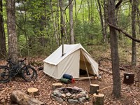
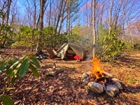
Here is what 2.27 acres looks like on the ground: roughly the size of two full city blocks. Enough space to park a truck and a trailer and still have the rest of the property ahead of you. Enough room to set up camp on one corner and walk to the other end and feel like you are somewhere different. Enough to have a fire, a tent, and open air around all of it without another parcel crowding the edges.
For someone who has never owned land and wants to know what that feels like, 2.27 acres in the Nevada high desert is a meaningful amount of ground. It is not a postage stamp. It is not a symbolic purchase. It is real, usable land with room to figure out what you want it to become.
Flat, accessible desert acreage with county road access and no HOA at this price point is worth acting on when it appears. This one is here now.
The Financing Makes This Realistic
Owning land in Nevada does not require a down payment that takes years to save.
This parcel is listed at $7,795 cash, and owner financing is available. The terms are straightforward: $205 down, $205 per month for 48 months. No bank involvement. No credit check hurdles. A one-time doc fee of $249 applies at signing.
For a buyer who has been waiting until the financial picture was right, this is the financial picture being right. The monthly payment is fixed. The terms are clear. The land is yours from the moment the paperwork is signed - and you can be standing on it the following weekend if you want to be.
There is no complicated process here. It is designed for buyers who are ready to own something and want a path that does not require navigating a mortgage or a lending institution. You call, you ask your questions, you make a decision that feels clear and confident, and the land is yours. Affordable Nevada land for sale does not always come with legitimate road access, real acreage, and a financing structure this straightforward. This one has all three.
Why This Parcel
There is a version of the next few years where you own 2.27 acres of Nevada high desert.
Where you have somewhere to drive when you need the sky to be bigger than your current address allows. Where the stars are not ambient light filtered through a city - they are actual stars, thousands of them, over land that belongs to you. Where the history of the ground beneath your feet goes back further than anything you have lived on before.
For a buyer who has never owned land, that first parcel is less about what you do with it and more about what it does for you. The confidence that you can own something. The proof that the version of your life you have been picturing is actually available.
This parcel is not asking you to commit to a lifestyle you have not figured out yet. It is asking you to own a piece of open ground in northeastern Nevada while the price and the financing make it accessible. Camp on it. Drive out on long weekends. Watch the stars from a place that is genuinely yours. Any of those is a legitimate reason to call.
Apn:
Acres: 2.27
Price: $7,795
Down Payment: $205
Monthly Payment: $205
Term: 48 months
Doc Fee: $249 (one-time)
Annual Taxes: $24
Access: 15th St NV - county-maintained dirt road
Elevation: 5,343-5,352 ft
Closest Cities: Wells, Elko, Carlin
Highways: US Hwy-80 / Rt-225
HOA: None
Zoning: Rural
If part of you has been thinking about owning land in the Nevada desert for a while - somewhere to drive to, somewhere to camp under open sky, somewhere that is actually yours - do not let that feeling sit too long without acting on it.
That kind of decision deserves a real conversation, not a rushed one.
Call our team today and let's talk through what ownership would actually look like for you.
You will speak with someone who takes this seriously and will make sure you feel confident before anything is signed.
State: Nv
County: Elko
Zip: 89801
Size: 2.27 acres
Apn:
Legal Description: Twin River Ranchos INC Unit NO 2 File 4943,Located
In The Se4sw4 Of,Mdb&M
Lat/Long Coordinates:
Nw: 40.989026,-115.634943
Ne: 40.989027,-115.63377
Sw: 40.988195,-115.634973
Se: 40.988195,-115.6338
Elevation: 5,352 ft feet
Annual Taxes: Approx. $$24 per year
Zoning: Residential
Flood Zone: No
HOA/POA: No
Improvements: No improvements done.
Access: Dirt Road
Water: Will need to install a Well
Sewer: Will need to install a Septic System
Utilities: Utilities Available nearby
Owner Financing:
- $205 down (plus the $249 non refundable doc fee)
$205 down $205/Mo for 48 months (plus prorated taxes and note maintenance fee)
We do not offer owner financing for residential use or full-time living on the property during the financing term.
Lot Maps & Attachments
Directions to Lot
From Wells, Nevada 89835 to la Vis, Elko, NV 89801
-Get on I-80 W 3 min (1.4 mi)
-Head toward Lake Ave 0.3 mi
-Turn left onto Humboldt Ave 0.8 mi
-Turn right to merge onto I-80 W toward Elko/Reno 0.3 mi
-Follow I-80 W to Coal Mine Canyon Rd. Take exit 314 from I-80 W 30 min (35.8 mi)
-Merge onto I-80 W 35.5 mi
-Take exit 314 toward Coal Mine Canyon Rd 0.2 mi
-Continue on Coal Mine Canyon Rd to your destination 13 min (5.3 mi)
-Turn right onto Coal Mine Canyon Rd 2.5 mi
-Turn left onto Indian Hills Dr/Quartzite St
-Continue to follow Quartzite St 0.8 mi
-Continue onto la Visa Dr 410 ft
-Continue onto 8th St/La Vista
-Continue to follow La Vista 1.3 mi
-Turn right 0.1 mi
-Turn left at the 1st cross street 0.2 mi
-Turn right at the 1st cross street 0.1 mi
-Turn left at the 1st cross street
-Destination will be on the right 0.2 mi
More Lot Details
More Lots from Chris Palsgrove
 3.2 AC : $45.8K
- 1.4 AC : $23.7K
- 1.4 AC : $20K
- 0.4 AC : $50K
- 0.3 AC : $3.5K
- 0.4 AC : $6K
- 1.1 AC : $18K
- New4.9 AC : $8K
- 0.4 AC : $4.7K
- 0.3 AC : $3.2K
- 0.4 AC : $50K
- New0.3 AC : $3.4K